
Jetzt NEU:
Wähle eine Webcam:
Gerlitzen Gipfel
(1.911m) Google MapsDetaillierte Wetterwerte hier!

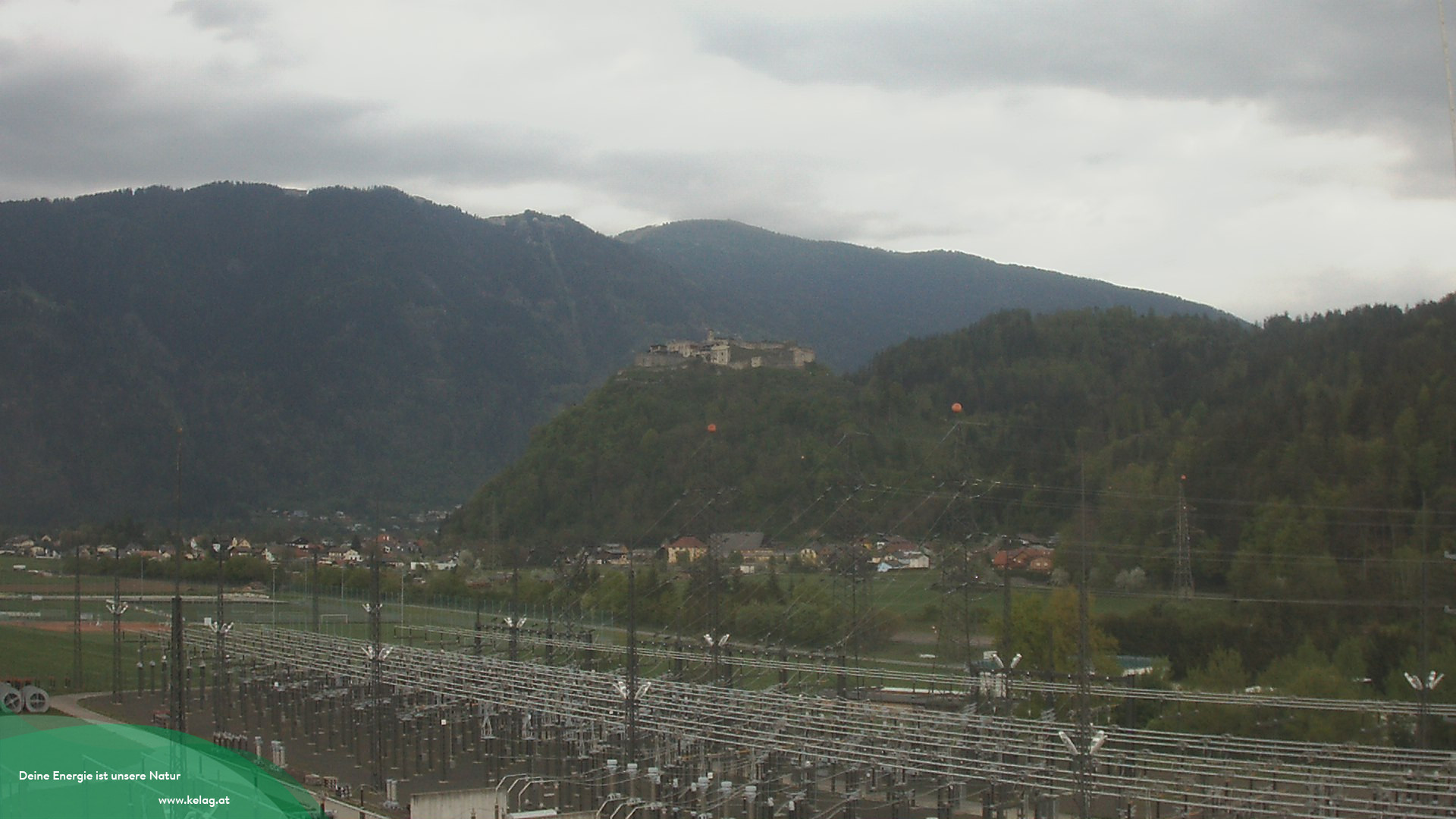 |
| Landskron mit Blick in Richtung Gerlitzen |
Gerlitzen Gipfel - Pacheiner
(1.911m)Wetterdetails

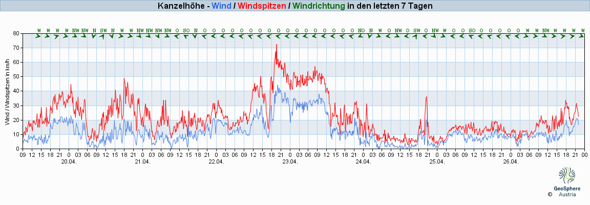
Gerlitzen Kanzelhöhe
(1.463m)Wetterdetails


Strandbad Annenheim
(545m)Google MapsWetterdetails

Dobratsch
(2.144m) Google MapsDetaillierte Wetterwerte hier!


Radsberg
(428m) Google MapsWetterdetails


Zauberkogel
(2.144m)Wetterdetails | Fluggebietinfos 1 | Fluggebietinfos 2
Mittagskogel
(2.145m) Google MapsWetterdetails

Bad Kleinkirchheim - Kaiserburg
(2.055m) Google MapsWetterdetails


Dreiländereck
(1.440m) Google MapsWetterdetails


Emberger Alm
(1.940m) Google MapsWetterdetails (weitere Windwerte hier)

Monte Lussari
(1.789m) Google MapsWetterdetails


Goldeck
(2.051m) Google MapsWetterdetails 1 (Wetterdetails 2)


Monte San Simeone
(1.175m)Google MapsWetterdetails


Gemona - Monte Cuarnan
(1.372m) Google MapsWetterdetails

Zettersfeld
(2.200m)Google MapsWetterdetails

Mölltaler Gletscher - Schareck
(3.123m) Google MapsWetterdetails


Petzen
(1.750) Google MapsWetterdetails


Koralpe - Großer Speikkogel
(2.140) Google MapsWetterdetails

Golzentipp, Obertilliach
(2.092m) Google MapsWetterdetails


Sillian
(2350m) Google MapsWetterdetails


Grpišca, Kranjska Gora
(1.629m) Google MapsWetterdetails
Kobala, Tolmin
(1.080m)Wetterdetails
Lijak
(590m)Wetterdetails
Mangart
(1.629m)Wetterdetails

Stol
(1.405m)Wetterdetails
Vogel
(1.405m)Wetterdetails


